

River-system intelligence, from a single reach to the whole planet.
Confluvio is a specialist hydroinformatics and geospatial consultancy. Engineering firms, international organizations, conservation NGOs and development banks bring us in for the analytical work at the centre of water, energy and environmental programmes.
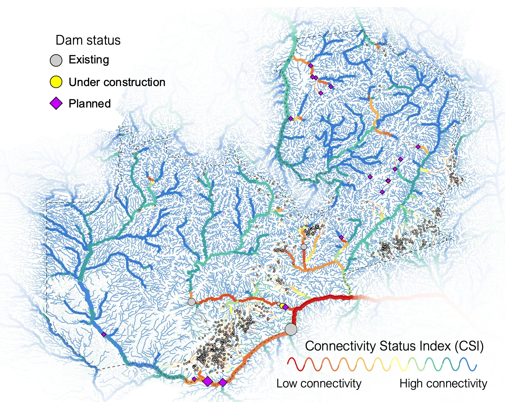
Hydropower configuration scenarios for Zambia
River connectivity across Zambia, with existing, under-construction and planned dams.
Reference data our team helped build
The same people who work on your assignment developed datasets that hydrologists, conservation planners and engineers rely on worldwide.
- HydroSHEDS
Global river networks and watershed boundaries, now refined from TanDEM-X elevation data in version 2.0.
- HydroATLAS
Standardized hydro-environmental attributes for every sub-basin and river reach on Earth.
- Free-flowing rivers
The first global map of river connectivity, published in Nature in 2019.
- EU-Hydro 2.0
The next reference hydrography for Europe, developed for the European Environment Agency.
Selected work
Global data foundations, continental hydrography, regional river networks and practical decision-support tools.
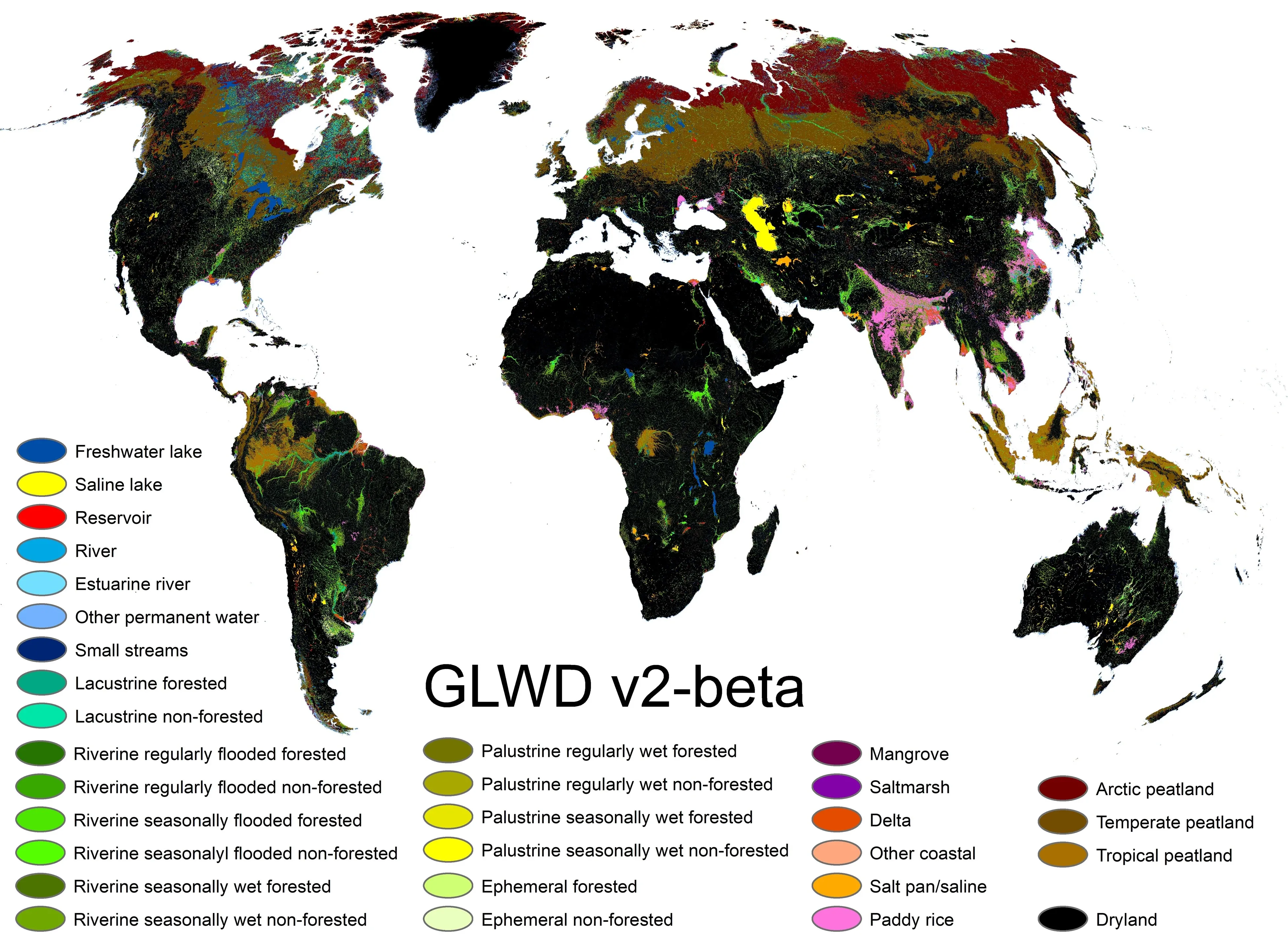
Global Inland Waters - 30x30 indicator
Inland waters of the world, classified for the 30×30 conservation indicator.
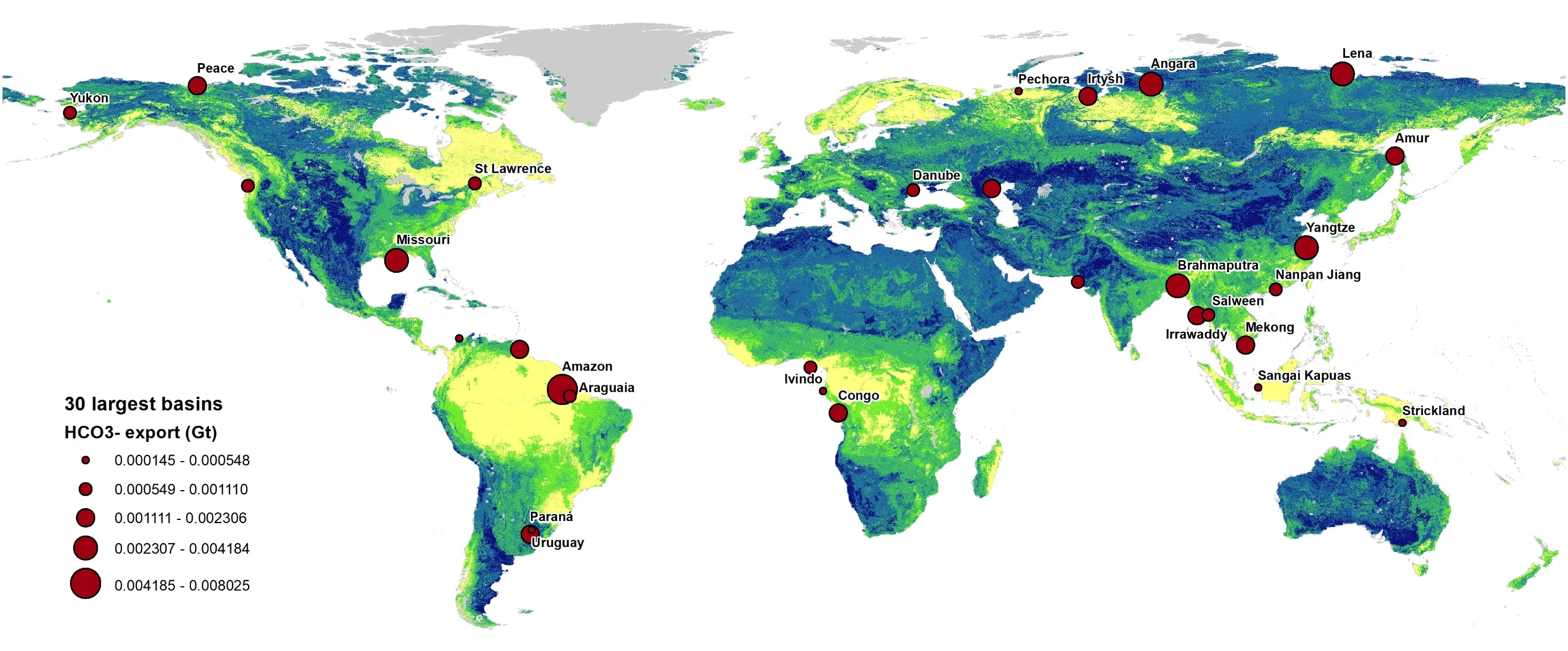
Global bicarbonate export and CO2 sequestration potential
Bicarbonate export from the 30 largest river basins.
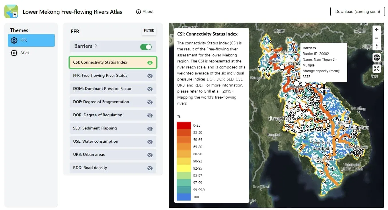
Mekong River connectivity assessment and toolbox
The Lower Mekong Free-flowing Rivers Atlas, a web tool for connectivity assessment.
Project index
| Project | Region | Client or status |
|---|---|---|
| Connectivity indices for protected areas in Canada | Canada | Environment and Climate Change Canada |
| EU-Hydro 2.0: Reference hydrographic dataset for Europe | Europe | European Environment Agency (Copernicus Land Monitoring Service) |
| Freshwater prioritization tool for Europe | Europe | The Nature Conservancy Europe (Freshwater Team) |
| Global bicarbonate export and CO2 sequestration potential | Global | CarbonRun |
| Global Inland Waters - 30x30 indicator | Global | The Nature Conservancy |
| Hydropower configuration scenarios for Zambia | Zambia | WWF-Zambia |
| Identifying Key Biodiversity Areas in Canada | Canada | Quebec Centre for Biodiversity Science (QCBS) |
| Mekong River connectivity assessment and toolbox | Lower Mekong region | WWF-US / USAID, with WWF-Greater Mekong |
Capabilities
Focused expertise for the analytical and decision-support work packages inside larger water, energy and environmental assignments.
All capabilities- Hydroinformatics
Hydrologic data frameworks, scalable processing pipelines and analysis-ready datasets from catchment to continental scales.
- River networks & connectivity
Network-based assessments of fragmentation, free-flowing rivers, freshwater corridors and cumulative pressure.
- Water resources & hydrology
Spatial hydrology, water-resource indicators and decision-ready assessment in data-rich and data-scarce settings.
- Hydropower & energy planning
Spatial scenario analysis that makes energy, river connectivity and conservation trade-offs visible.
- GIS & remote sensing
High-resolution geospatial processing, Earth-observation interpretation and quality-controlled spatial products.
- Decision support & web mapping
Practical tools that turn complex environmental evidence into transparent, usable decisions.
Specialist capacity that fits the assignment
We join your team at the level of involvement the project needs.
Technical subcontractor
A defined analytical, data or tool-building scope within a wider programme.
Consortium member
Named specialist capacity within a multidisciplinary bid and delivery team.
Work-package lead
Ownership of a specialist workstream, including methods, quality assurance and handover.
Bring specialist water-systems expertise into your next assignment
Tell us what the project needs and where Confluvio could contribute.