

Context
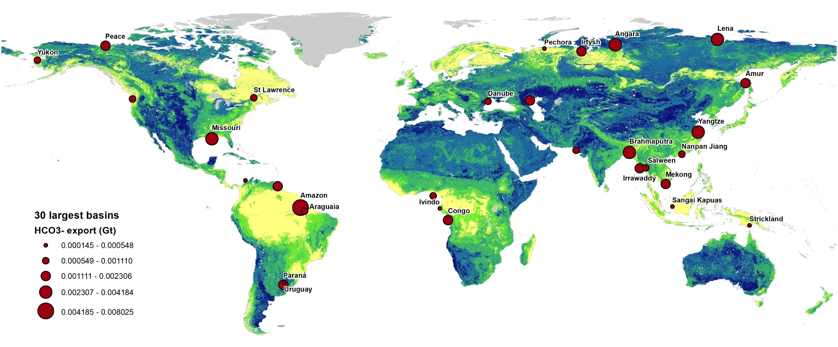
River systems carry bicarbonate from land to the ocean, where it can contribute to long-term carbon storage. Understanding where that flux is largest, and how it might change, requires a spatially explicit global assessment.
Confluvio’s role
Confluvio partnered with CarbonRun to build a spatially explicit assessment of how much bicarbonate reaches the ocean at river mouths, under current conditions and under alkalinity-enhancement scenarios. Confluvio also delivered a Python geospatial toolbox for scenario analysis. The work began in 2022 and is ongoing.
Methods and data
Published global bicarbonate distributions were combined with runoff and river-discharge data to estimate mass flux at basin outlets. The toolbox takes standard input layers (bicarbonate, runoff, basins, ocean-outlet masks) and configurable parameters (concentration targets, enhancement rules), and aggregates results to countries, marine ecoregions and basins.
Results
The assessment provides a spatially resolved view of where river-to-ocean bicarbonate flux is largest today and where enhancement could materially change delivery to the ocean. It is structured to support estimates of CO2 sequestration potential and carbon accounting, with global results, detail for Canada and summaries by major ocean region.